Geoportal de Chile
Descubre 8664 datos territoriales
Contenido Destacado
hace 6 meses
hace 6 meses
hace 6 meses
hace 6 meses
hace 6 meses
hace 6 meses
hace 6 meses
hace 5 meses
Buscar por categorías


Últimos datos agregados
Propiedad Fiscal Administrada
El Ministerio de Bienes Nacionales, a través de la División del Catastro Nacional de los Bienes del Estado, es el encargado de formar, mantener y actualizar el Catastro de Bienes Raíces de propiedad Fiscal (D.L N°1.939/1979, D.L. N° 3.274/1980 y D.S.N° 386 de 1981). En este contexto, continuando con la política de transparencia y eficiencia que hemos privilegiado en la gestión de inmuebles fiscale...
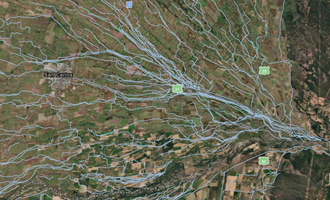
Coordenadas Estaciones CORS del modelo de deformación: ADELA Analysis of Deformation beyond Los Andes 2009 2021
Los marcos de referencia (RF) modernos que se utilizan actualmente en Chile son
estático, llamado SIRGASChile @ 2013 (Realización3) y
SIRGASChile @ 2016 (Realización4). Están oficialmente acostumbrados a
realizar catastro en el primero y como marco oficial para
el país en el segundo caso. Estos RF son densificación de
la red SIRGAS para una época fija determinada; el tiempo dependiente no est...
Acumulacion de compuestos nitrogenados en relación al problema de baya blanda en uva de mesa
Con el objeto de evaluar la probable incidencia de trastornos del metabolismo del N en el problema denominado baya blanda de la vid, a inicio de la cosecha 2002 se recolectaron muestras de bayas y raquis de racimos procedentes de un parronal Vitis vinifera L. cv. Thompson Seedless de la VI Region, Chile (34º15' lat. Sur, 72º25 long. Oeste) con presencia de bayas blandas, intermedias y fir...
Composición botánica de la dieta de alpacas (Lama pacos L.) y llamas (Lama glama L.) en dos estaciones del año, en praderas altiplánicas de un sector de la provincia de Parinacota, Chile
Se determino la composición de las dietas de alpacas (Lama pacos L.) y llamas (Lama glama L.) que pastorearon praderas altiplánicas de Parinacota, Chile (18º12' lat. Sur; 69º16' long. Oeste; 4390 m.s.n.m.) utilizando microhístologia fecal. Las evaluaciones se realizaron en la época seca-invernal y la lluviosa-estival. Se midió la disponibilidad de materia seca (MS) y composición...
Comparación entre los métodos de la pipeta y bouyoucos y su relación con la retención de agua en ocho suelos de la zona altiplánica de la provincia de Parinacota, Chile
El objetivo de esta investigación fue comparar dos métodos, de la pipeta y Bouyoucos, para cuantificar la distribución y tamaño de partículas en suelos de regiones áridas frías. Para ello se muestrearon ocho suelos (29 muestras) del altiplano, en la Provincia de Parinacota. Con los resultados se efectúo un análisis de regresión lineal, se obtuvo la ecuación de la recta y el gráfico de dispersión c...
Análisis de eficiencia y rentabilidad económica en dos lecherías de la Región del Maule
Se determinaron indicadores de eficiencia y rentabilidad económica de la produccion de leche en dos predios de riego ubicados en la zona de Linares (35º51' lat Sur, 71º35' long Oeste) Region del Maule, Chile. Para la evaluacion económica de los predios, se estimo la tasa de descuento
utilizando el Modelo de Valorización de Activos de Capital (CAPM) y el Costo de Capital Promedio Pondera...

Acerca de
En el Catálogo Nacional de Información Geoespacial es posible encontrar información de productos geoespaciales generados por las instituciones del Estado. Entre ellos se encuentran los mapas digitales publicados en sitios web, y también otros formatos que contienen información geoespacial tales como estudios, informes, cuadros estadísticos, tablas, entre otros.
Copyright © 2024 IDE Chile. Todos los derechos reservados.